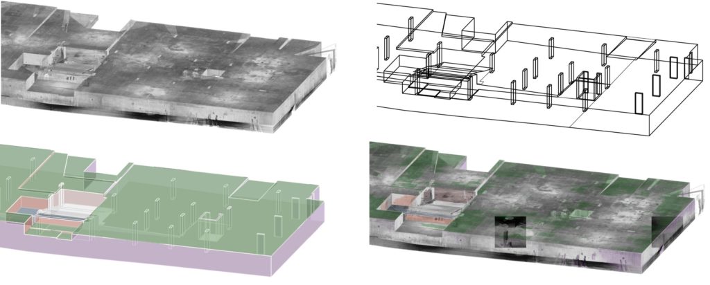
3D Modelling Service

Point cloud data derived from 3D Laser Scanning is a powerful tool to utilize large data sets to create 3D Models for a diverse range of disciplines. Axiom Spatial can advise the best way to approach any type of project whether a small scale Boma Survey or a large shopping centre complex, Axiom Spatial has the resources and expertise regardless of complexity.

Our laser scanning team can save time and money by combining highly accurate 3D laser scanning and the latest 3D modelling software including Rhino, Revit, Microstation, Autocad, Cyclone, TopoDot and Recap. We can supply any form of deliverable from the basic point cloud file to large scale Revit model.

Feel free to contact our team to discuss your project requirements.

Get A Free Quote

Axiom Spatial provides innovative land surveying solutions to commercial, government and private clients NSW wide. Our surveyors and support staff participate in continuous professional development provided by The Institution of Surveyors and NSW Consulting Surveyors, ensuring that we have the skills to remain at the cutting edge of land surveying technologies, methods and legislative change. Axiom Spatial is owned and operated by NSW Registered land surveyors.

Hear What Our Customers Like To Say About Us